

Creative Arts
Studio Extension E5Relief & Scale Displays
Professor Cogbranch Timberclank
Master Artisan, Head of House Occidens
The Creative Arts Workshop • School of Evershade
This is a Studio Extension: optional, always, and never required for any lesson in any class. It assumes these tickets are already in your hands: Lesson 7, "Paper, Card & Board Construction," Lesson 20, "Clay II: Vessels, Tiles, Relief & Molds," and Lesson 23, "Wood, Grain & Safe Hand Tools." If one of those is missing, take it first. A display fails at its foundations like anything else, and this build's foundations are those three lessons.
Professor's Introduction

Bring your sketches, your logs, and your card models, scholars, from Professor Glimmerwick's tower and Professor Fernfoot's greenhouse: the Moon drawn a dozen times, the garden planned on paper, the little models that taught the shape of a thing and then came apart in a schoolbag.
A sketch is an argument made quickly. A display is an argument made to stand in a room and be believed by people who were not there when it was drawn. This extension builds the standing version: a relief or a scale display fit for a classroom wall or the Gallery, a relief Moon at display scale, a planetary system whose sizes are true and whose distances confess themselves, a garden in relief that a class can plan over, a constellation chart built permanent for our own latitude. In this workshop, relief is ground that rises: a surface modeled so that height is shown by height, not by shading, and it is read by the hand as much as the eye. The craft is Lesson 20's relief work grown to room size, and Lesson 7's board construction carrying it, and Lesson 23's framing holding it all where eyes can reach it.
The kings of France kept a whole museum of such arguments, built by engineers and guarded like treasure. You will see why, and you will see what the guarding was for: a scale display is a claim about the world, made solid, and claims made solid must be honest about what they have bent to fit the room.
PROFESSOR COGBRANCH TIMBERCLANK
Creative Arts Workshop
Master Artisan, Head of House Occidens
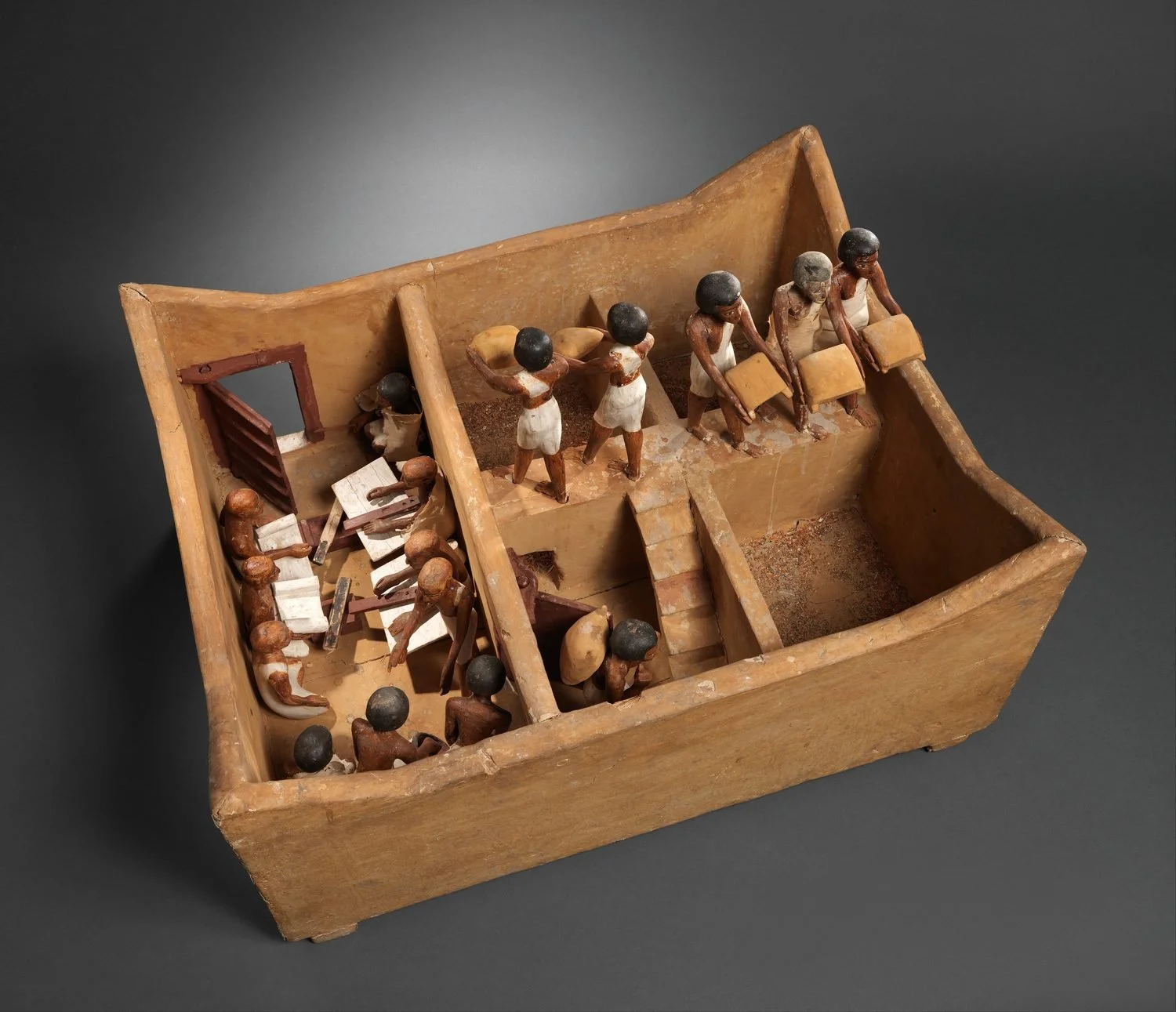
The Model of a Granary with Scribes from the tomb of Meketre (Egypt, ca. 1981–1975 BCE) — a wooden scale model, 74.9 cm long: grain bins, six porters carrying sacks, and nine scribes measuring and recording.
The Metropolitan Museum of Art, Open Access (CC0).
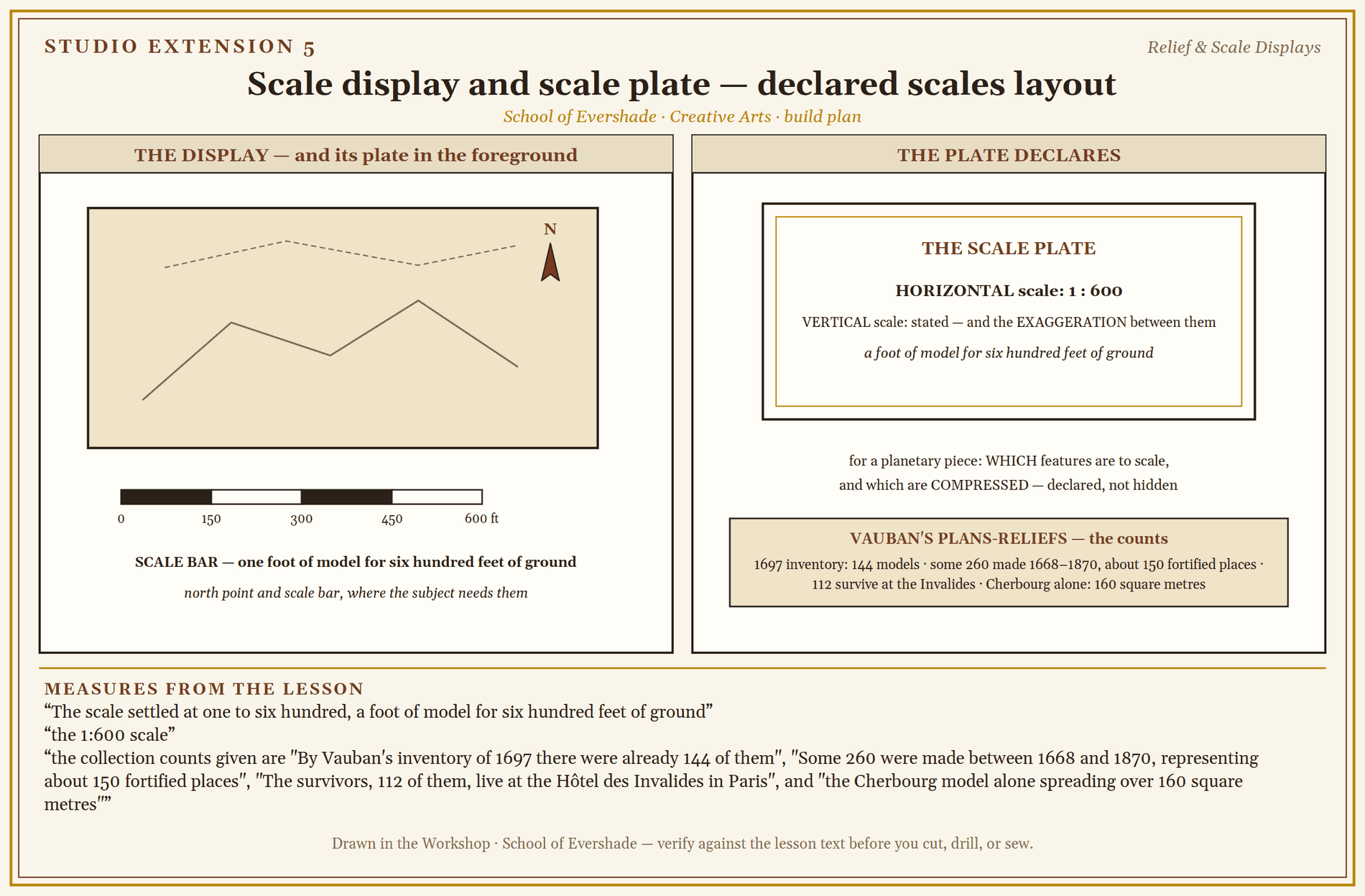
Scale display and scale plate — declared scales layout
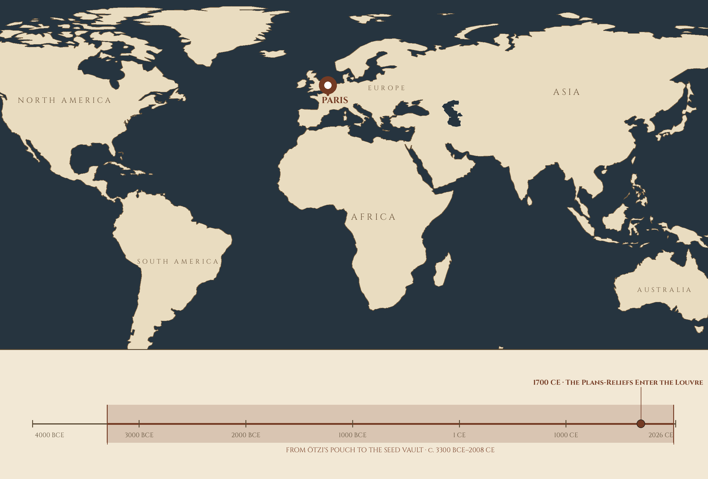
Where and when: Paris — 1700 CE, the plans-reliefs enter the Louvre.
Lesson Objectives
By the end of this extension, students should be able to:
- Describe the plans-reliefs of Louis XIV's France: their scale, their military purpose, their makers, and where the survivors live now.
- Trace the raised-relief map's older history, from the early Chinese relief models through Shen Kuo's model of the eleventh century to the layer-stacked construction used today.
- Explain vertical exaggeration: why terrain models heighten their relief, and why the exaggeration must be declared on the piece.
- Distinguish the three honesties of a scale display: true sizes, true distances, and true shapes, and explain why a room-sized solar system cannot keep true relative sizes and true relative distances at once while its planets stay large enough to see.
- Build a relief by contour-layer stacking, smooth and paint it, and frame it for display.
- Write a scale plate that states the display's scale, its exaggerations, and its compressions, so no viewer is deceived by it.
Your Assignment Packet
This lesson's assignments live in its packet: the Lexicon Handout (every term, course terms marked ◆), the Assignment Manual, and the Reflection Questions. Download the packet before you begin and keep it beside you as you read — work from it as each subject is taught, or take the assignments as homework afterward.
The King's Models: The Plans-Reliefs
In 1668 François-Michel le Tellier, Marquis de Louvois, war minister to Louis XIV, began a collection unlike anything a state had attempted: three-dimensional models of France's fortified towns, built to scale, showing every bastion, curtain wall, hill, and harbour as the engineers surveyed them. The scale settled at one to six hundred, a foot of model for six hundred feet of ground, and the collection was built by military engineers, first in the field and later in central workshops established at Béthune and Lille in 1743. By Vauban's inventory of 1697 there were already 144 of them. In 1700 Louis installed the collection in the Louvre, where it served the purposes such models serve: planning works and briefing councils that would never see the frontier, and displaying the reach of the crown to the few admitted to the gallery. Some 260 were made between 1668 and 1870, representing about 150 fortified places, and the making stopped only when artillery outranged the bastioned fortress itself. The survivors, 112 of them, live at the Hôtel des Invalides in Paris, where the museum of plans-reliefs keeps them still, the Cherbourg model alone spreading over 160 square metres. They are now priceless historical evidence, showing towns as they stood three centuries ago, but their makers did not build them as history. They built them as instruments: a relief you could walk around, argue over, and trust, because its scale was its oath.
Older Ground: The Raised-Relief Map
France's kings were late to an old craft. In eleventh-century China, the polymath Shen Kuo made a raised-relief map of wood, sawdust, beeswax, and wheat paste, modeling the frontier country he had surveyed; the emperor was so pleased that he ordered the prefects of the frontier regions to prepare wooden relief maps of their own districts and send them to the capital, which may be the first state relief-map programme on record. In 1130 Huang Shang made a wooden relief map assembled from eight hinged pieces, so it could fold and be carried by one person, a display built to travel. The construction these makers would recognize is the construction of this extension: draw the ground's contour lines, cut a layer for each line, stack the layers in order, and the terrain rises in steps, to be smoothed, molded, or left honestly stepped. Modern raised-relief maps exaggerate the vertical five to ten times to make terrain legible, and the good ones say so on their faces. That heightening is vertical exaggeration, the deliberate heightening of a model's relief beyond its true scale, so hills read as hills instead of wrinkles: a legitimate tool, and, undeclared, a lie with good finish. The method's patience is its lesson. A relief is a map that took the time to stand up.
A Sealed Note from Professor Timberclank
A display's hazards arrive at the end of the build, scholars, when everyone is tired and the piece is large.
The cutting is under the old rules: stacked board is cut with the work clamped, blades away from the body, and a relief's layers are cut flat on the bench, never trimmed in the hand at the model's edge where the knife wants to wander uphill.
Sanding a smoothed relief raises the finest dust in this course. It is done outdoors or with the dust kept down and out of the breath, and the vacuum or the damp cloth, not the lungs, does the collecting.
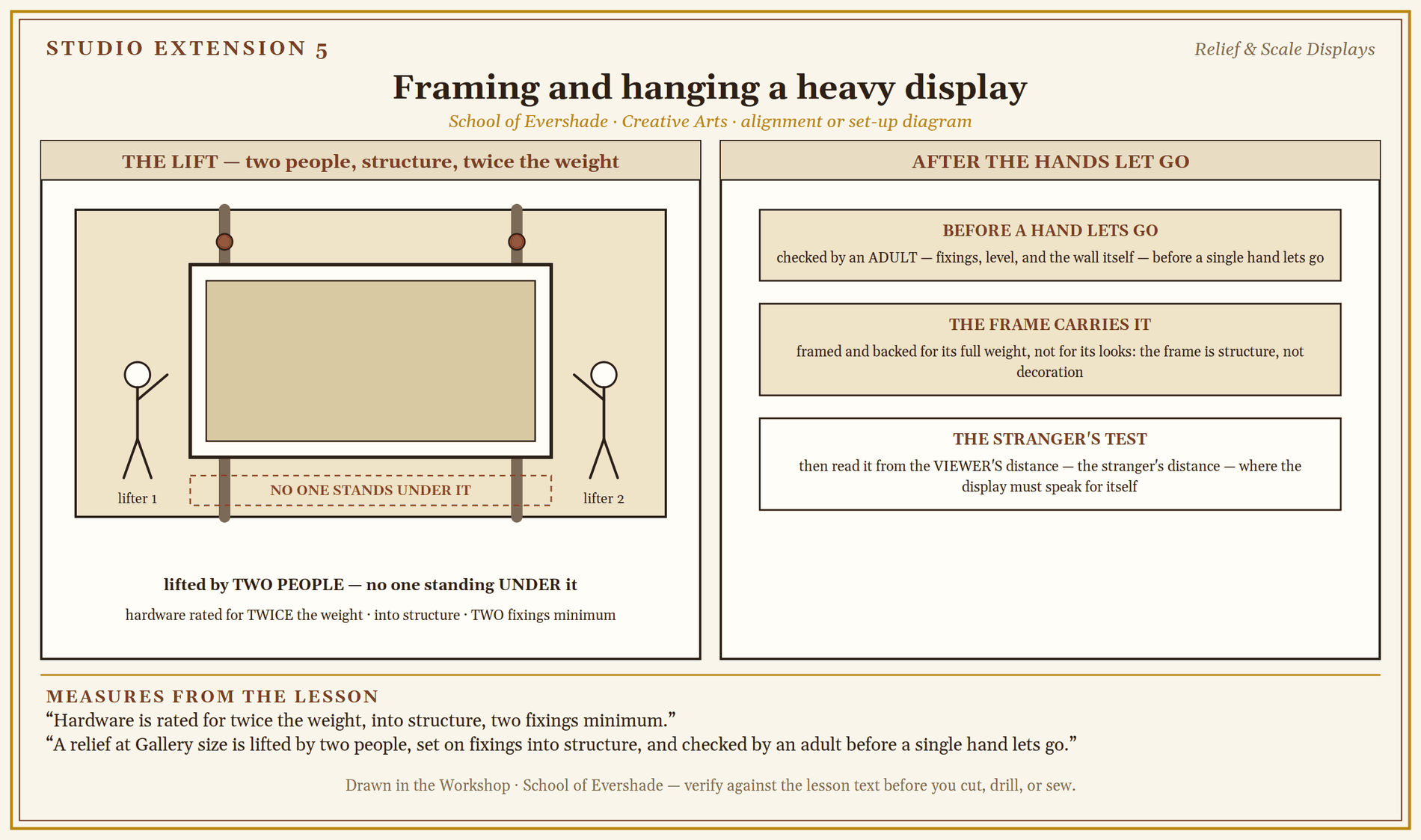
And the finished display is the heaviest thing this course hangs. A relief at Gallery size is lifted by two people, set on fixings into structure, and checked by an adult before a single hand lets go. No scholar stands under a piece that is being hung, ever, for any reason, however steady it feels. We stop. We make it safe. Then we begin again.
PROFESSOR COGBRANCH TIMBERCLANK
Creative Arts Workshop
Master Artisan, Head of House Occidens
Technique: Layers, Steps, and the Declared Lie
Choose the subject by its teaching, not its looks. A relief Moon for the Celestial wall, a relief of the school grounds or the garden for planning over, a scale system of Saturn's rings and moons, a wall-size twelve-world solar system for the Gallery: each teaches a different lesson, and the build begins by naming it. A display that teaches nothing is furniture with pretensions.
Set the scales in the log before cutting. Write down the horizontal scale, the vertical scale, and the exaggeration between them, and for a planetary display, which features are to scale and which are compressed. These numbers are the build's contract. The scale plate at the end is this page of the log, lettered fair. Two phrases are kept separate in this extension: true scale is a property a model may or may not have, and declared scale is a duty it always has — the plate declares, and the model does its best.
Stack with registration. Cut each contour layer with two registration holes in waste corners, and stack the layers on pins through those holes, so layer twelve cannot drift against layer eleven. A contour layer is one sheet of a relief build, cut along a single contour line of the map, so that stacking the sheets in order rebuilds the terrain in steps. Glue in small assemblies, weigh them down flat, and let each assembly cure before the next goes on. A tall relief built in one wet stack will lean by morning, and lean is a fault no paint can argue with.
Smooth, or confess the steps. The stacked relief may be smoothed with filler into continuous ground, in the plans-reliefs manner, or left stepped, in the manner of a teaching model that wants its contours visible. Both are honest. Smearing filler unevenly so the ground is neither is not a third option; it is a fault. Decide, and let the plate say which was chosen.
Paint from the chart, label for the room. Colors follow Lesson 15's discipline and the display's sources: the Moon in its true greys, terrain in colors a map-reader trusts. Labels are sized for the room the piece will hang in, read at the distance viewers will actually stand, and the scale plate sits where the eye lands first when it looks for the catch. There is always a catch in a scale model. The plate is where the honest maker puts it.
The Build: Ground That Stands Up
This build is checked for registered layers, declared scales, and a hanging that two people and an adult have proven.
- Choose the display and write its contract. Name the subject, its room, and its teaching. Write the horizontal scale, the vertical scale, and the exaggeration, or the sizes-versus-distances confession for a planetary piece, at the head of the log. This page becomes the scale plate.
- Prepare the contour set. Draw or trace the contours at the build's size, one line per layer, numbered in order from the ground up. Check the set by counting: a missing layer is a cliff in the finished ground, found now for free or later at full price.
- Cut the layers. Cut each layer along its contour, with registration holes in waste corners, under the sealed note's discipline. Keep the layers in order on the bench, numbered on their waste edges, as Lesson 19's tiles were labeled: the stack is a book, and its pages must not shuffle.
- Stack and glue in assemblies. Pin the first layers to the base through their registration holes, glue in small assemblies, weight flat, and cure between assemblies. Check the rising ground against the map at every third layer; drift corrected at layer three is a nudge, and at layer fifteen is a rebuild.
- Smooth or keep the steps. By the decision in your log: fill and sand the steps into continuous ground, outdoors or with dust kept down, or clean the stepped edges and let the contours show. Model the features that sit on the ground, craters, buildings, garden beds, ring systems, at the declared scales.
- Paint and label. Paint from the color chart and the sources, in the room's light. Set the labels for the viewing distance, and the north point, the scale bar, and the maker's plate where a viewer's eye goes looking for them.
- Frame and weigh. Frame or back the piece, and weigh it honestly, in the hands, before hardware is chosen. Hardware is rated for twice the weight, into structure, two fixings minimum.
- Hang, and read it as a stranger. Hang the display with two people on the lift and an adult checking the fixings, then stand at the viewer's distance and read it as someone who has never seen the subject. Whatever the stranger misunderstands is the plate's unfinished business. Correct the plate, or the labels, not the stranger.
When the ground stands true to its map, the plate confesses its scales, and the piece hangs where a room full of strangers can learn from it, the display has joined the oldest museum tradition in this course, and it is done.
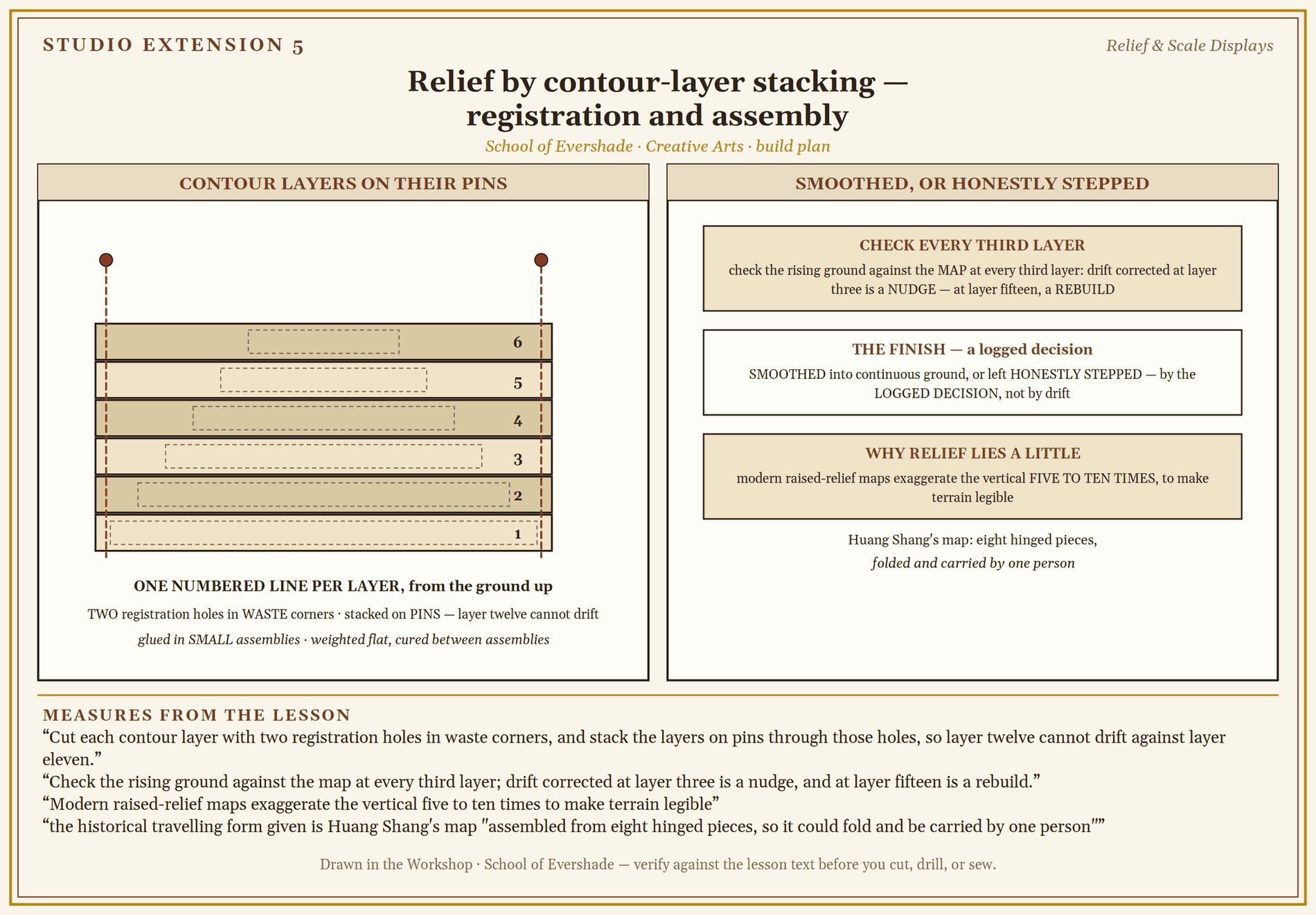
Relief by contour-layer stacking — registration and assembly
Framing and hanging a heavy display
Assignment Manual
Assignment key: ✎ written work · ⚒ hands-on practical · ◐ both
Assignment I ⚒ — The Build
Complete the Build in this extension: one relief or scale display built for a classroom or the Gallery, by contour-layer stacking or scale construction, smoothed or stepped by a logged decision, painted from sources, plated with its declared scales, and soundly hung.
Assignment II ✎ — Instruments of Argument
Using the lesson and the sources below, write a short account of the plans-reliefs. Cover: why a war minister wanted towns in three dimensions, how and at what scale they were built, what purposes beyond war the Louvre gallery served, and what the surviving models are evidence of now that their makers never intended.
Assignment III ◐ — The Stranger Test
Before your display is hung, write the three things you believe it teaches. After it hangs, have two scholars who did not watch the build study it for five minutes, plate included, and write what they take it to teach. Present the display's plate, your three, and their readings together, with an account of every difference and what you changed, or refused to change, because of it.
Materials
Level One (household)
- A contour source: a Moon map, a local map with contours, the garden plan, or the planetary data from the Celestial course
- Board, thick card, foam board, or plywood sheets for the contour layers, with a craft knife, fine saw, and cutting mat
- Glue, registration pins or skewers, filler for smoothing (modeling paste, plaster, or flour paste in the old manner), and weights
- Lesson 15's paints and color chart, with brushes for terrain and detail
- A frame or backing board from Lesson 23's stock, hanging hardware rated for the weight, and an adult for the hanging
- Card or brass for the scale plate
Level Two (historical)
Everything in Level One, plus:
- Solid wood layers or a carved wooden base relief in the plans-reliefs workshops' manner, with the buildings blocked in wood and detailed in card
- Plaster or gesso surfacing, smoothed and painted, for the continuous-ground finish
- Silk, flock, or fine natural materials for trees and planting, as the French workshops used chopped silk
- An engraved brass scale plate and a glazed frame, so the display keeps like the museum pieces it descends from
Both levels build the same display to the same oath: the scale is declared, the exaggeration is declared, and the piece hangs where it can be read. Level Two's materials will age like the Invalides models; Level One's honesty is expected to age exactly as well.
Reflection Questions
Answer the following questions in your workbook.
- The plans-reliefs were built to plan wars and are now kept to remember towns. What does a model preserve that its makers were not trying to preserve, and what does that mean for the displays you make?
- Vertical exaggeration makes terrain readable and makes it false, in the same stroke. Where is the line between a declared exaggeration and a deception, in a model and in a sentence?
- Shen Kuo's emperor ordered relief maps from every frontier prefect. What can a ruler, or a teacher, learn from a relief that a flat report cannot carry?
- A room-sized solar system can keep true sizes or true distances, not both. Which did you keep, and what does the choice say about what you wanted the viewer to understand?
- The stranger test corrects the plate, not the stranger. What does that rule assume about where misunderstanding lives, in a display and in a lesson?
Professor's Review
Let us stand in front of it together, scholars, at the stranger's distance, and be quiet a moment. It holds the wall the way a good sentence holds a page: nothing wasted, nothing pretending.
Three centuries ago a king's engineers built towns at one to six hundred so that men who would never see those towns could reason about them truly. Your relief stands in that line with this advantage over theirs: it was built to teach, and its plate tells the truth about its own bending, which theirs, for reasons of state, sometimes could not. A display that declares its scale can be trusted with everything else it says. That is the whole craft of this extension, and by the look of that wall, you have it.
Leave its log and its chart in the Gallery's keeping. Reliefs outlive their makers' memories, and the next scholar who must repair a layer will bless the hand that wrote down which layer it was.
PROFESSOR COGBRANCH TIMBERCLANK
Creative Arts Workshop
Master Artisan, Head of House Occidens
Further Reading & Sources
Wikipedia, "Musée des Plans-Reliefs." The collection's whole story: Louvois's beginning in 1668, the Louvre gallery, the move to the Invalides, and the 112 models conserved today.
Wikipedia, "Plan-Relief." The form defined, with the Strasbourg model: the 1:600 scale, Vauban's inventory of 144, and the workshops that kept the collection growing until 1870.
Wikipedia, "Raised-Relief Map." The older and wider craft: Shen Kuo's sawdust and wax frontier, Huang Shang's folding wooden map, and layer stacking explained as a construction method.
Student-friendly starting points for exploring this extension's world. All links verified October 2026.
- Network of Vauban's Major Sites. "La France en relief." The great exhibition of the plans-reliefs introduced: 1:600 towns built from field surveys down to the smallest details, and the Cherbourg model at 160 square metres.
- Wikipedia's survey of the raised-relief map, with its gallery. Handmade reliefs from the High Tatras to Guatemala's giant relief map of 1904–05: what the craft became in other hands.
- Print only: Isabelle Warmoes, Le Musée des plans-reliefs (Éditions du patrimoine, 1997), the museum's own illustrated guide to the collection and its making, held by larger libraries.
Submit your work for this lesson using the form below.
CONTINUE IN THE CREATIVE ARTS WORKSHOP
← Previous · Studio Extension E4: Painted Wheels at Full Size Next · Seasonal Workshop Special S1: Autumn: Harvest & Keeping →
Creative Arts Workshop · All 39 Lessons
Bookstore Shelf The Library · Creative Arts Shelf Course Supplies
The rest of the Workshop Extensions: E1 · Precision Paper Instruments · E2 · The Permanent Sundial · E3 · Models That Move · E4 · Painted Wheels at Full Size